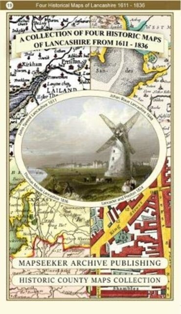
A Lancashire 1611 - 1836 - Fold Up Map that features a collection of Four Historic Maps, John Speed's County Map 1611, Johan Blaeu's County Map of 1648, Thomas Moules County Map of 1836 and a Plan of Lancaster and Preston from 1824. The maps also feature early Victorian views around Liverpool as well as Manchester and Blackpool.
€26.90
Product Information
| ISBN | 9781844918478 |
|---|---|
| Publisher | Historical Images Ltd |
| Price (excl. tax) | €25.38 |
| Tax | €1.52 |
| Price (incl. tax) | €26.90 |
| Availability | Unavailable |
Product Description
140 x 227 x 47