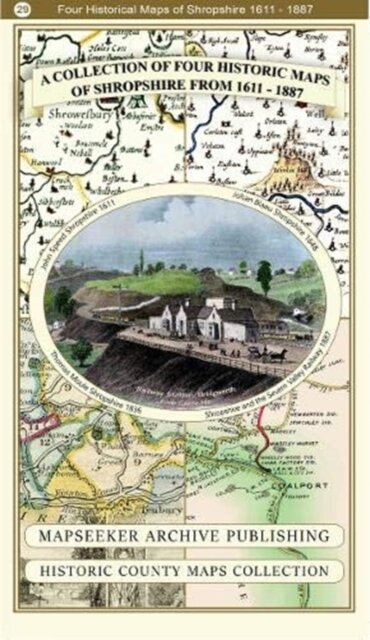
A Shropshire 1611 - 1836 - Fold Up Map that features a collection of Four Historic Maps, John Speed's County Map 1611, Johan Blaeu's County Map of 1648, Thomas Moules County Map of 1836 and a Map of the Severn Valley Railway in 1887.The maps also feature a number of early views across Shropshire including the famous Ironbridge over the Severn and t
€ 26,90
Informação do Produto
| ISBN | 9781844918447 |
|---|---|
| Editora | Historical Images Ltd |
| Preço (iva excl.) | € 25,38 |
| Imposto | € 1,52 |
| Preço (iva inc.) | € 26,90 |
| Disponibilidade | Indisponível |
Descrição do Produto
139 x 228 x 55